National Fire Danger Rating System

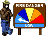
This is the NFDRS Fire Index used by the National Forest Service:


226502 - COVINGTON
Covington County, Mississippi
Elev: 290´   Lat: 31.7°   Long: - 89.5°
Observed    17-Dec-24
ERC: BI: SC: STL: IC: ADJ: L
fire sign

Forecast    19-DEC-24
ERC: BI: SC: STL: IC: ADJ: L
fire sign


×
Color Code Explanation

Managers at the National Forest Service use the National Fire Danger Rating System (NFDRS) to input data and to receive information used to determine fire danger in their area. Based on the fire danger, managers may impose restrictions or closures to public lands, plan for or pre-position staff and equipment to fight new fires and to make decisions whether to suppress or allow fires to burn under prescribed conditions. NFDRS components:

Fire Danger Class and Color Code Description
Low (L)
(Green)
Less than 50
Fuels do not ignite readily from small firebrands, although a more intense heat source such as lightning, may start fires in duff or punky wood. Fires in open cured grasslands may burn freely a few hours after rain, but woods fires spread slowly by creeping or smoldering, and burn in irregular fingers. There is little danger of spotting.
Moderate (M)
(Blue)
50 to 75
Fires can start from most accidental causes, but with the exception of lightning fires in some areas, the number of starts is generally low. Fires in open cured grasslands will burn briskly and spread rapidly on windy days. Timber fires spread slowly to moderately fast. The average fire is of moderate intensity, although heavy concentrations of fuel, especially draped fuel, may burn hot. Short-distance spotting may occur, but is not persistent. Fires are not likely to become serious and control is relatively easy.
High (H)
(Yellow)
75 to 90
All fine dead fuels ignite readily and fires start easily from most causes. Unattended brush and campfires are likely to escape. Fires spread rapidly and short-distance spotting is common. High-intensity burning may develop on slopes or in concentrations of fine fuels. Fires may become serious and their control difficult unless they are hit hard and fast while small.
Very High (VH)
(Orange)
90 to 97.5
Fires start easily from all causes and, immediately after ignition, spread rapidly and increase quickly in intensity. Spot fires are a constant danger. Fires burning in light fuels may quickly develop high intensity characteristics such as long-distance spotting and fire whirlwinds when they burn in heavier fuels.
Extreme (E)
(Red)
Above 97.5
Fires start quickly, spread furiously, and burn intensely. All fires are potentially serious. Development into high intensity burning will usually be faster and occur from smaller fires than in the very high fire danger class. Direct attack is rarely possible and may be dangerous except immediately after ignition. Fires that develop headway in heavy slash or in conifer stands may be unmanageable while the extreme burning condition lasts. Under these conditions the only effective and safe control action is on the flanks until the weather changes or the fuel supply lessons.


×
Adjective Fire Danger

The Adjective Class Fire Danger Rating should only be utilized for public information. Staffing Level (SL or STL) is used for in-house fire readiness.

Using the IC, the SL (STL), and the Adjective Fire-Danger Matrix, WIMS determines the Fire Danger Rating (R). Adjective Fire-Danger is expressed as one of five levels:

  • Low (L) or Green
  • Moderate (M) or Blue
  • High (H) or Yellow
  • Very High (VH or V) or Orange
  • Extreme (E) or Red

The processors that calculate fire danger automatically calculate the adjective class rating using information provided by the user when establishing their weather station parameters. The adjective rating calculations are keyed off the priority one fuel model listed in your station record. It uses the staffing index, such as ERC or BI, the user associates with that first fuel mode/slope/grass type/climate class combination entered.

The actual determination of the daily adjective rating is based on the current or predicted value for a user selected staffing index and ignition component using the table below.

Staffing Levels (SL or STL) Adjective Fire Danger Rating (R)
1-,1,1+ L L L M M
2-,2,2+ L M M M H
3-,3,3+ M M H H VH
4-,4,4+ M H VH VH E
5-,5,5+ H VH VH E E
Ignition Component 0-20 21-45 46-65 66-80 81-100


×
NFRDS Data Legend

Date = Date

Stn# = Station Number

Station = Station Name

St = State

Elev = Elevation

Lat = Latitude

Long = Longitude

Mdl = Model Number

Tmp = Temperature

RH = Relative Humidity

Wind = Wind Speed in MPH

PPT = Precipitation - Observed or Forecast Precipitation Hours

ERC = Energy Release Component - Based upon the estimated potential available energy released per unit area in the flaming zone of a fire. It is dependent upon the same fuel characteristics as the spread component (SC). The day to day variations of the ERC are caused by changes in the moisture contents of the various fuel classes, including the 1000 hour time lag class. ERC is derived from predictions of the rate of heat release per unit area during flaming combustion and the duration of the burning. Expressed in BTU's per square foot.

BI = Burning Index - A measure of fire intensity. BI combines the Spread Component and Energy Release Component to relate to the contribution of fire behavior to the effort of containing a fire. BI has no units, but in general it is 10 times the flame length of a fire.

SC = Spread Component - A rating of the forward rate of spread of a head fire. It integrates the effect of wind, slope, and fuel bed and fuel particle properties. The daily variations are caused by the changes in the wind and moisture contents of the live fuels and the dead fuel timelag classes of 1, 10, and 100 hr.

KBDI = Keetch-Byram Drought Index - A number between 0-800 representing the amount of moisture in the top 8 inches of soil. Zero is saturated, 800 is maximum drought stress. It is calculated from recent precipitation measurements in relation to the average annual precipitation. It is important to note that the KBDI is customized for each geographic area and that often the scale shows less of a range in variation. (-99 = No Annual Precip for Station)

HUN = 100 Hour Fuel Moisture - This value represents the modeled moisture content of dead fuels in the 1 to 3 inch diameter class. It can also be used as a very rough estimate of the average moisture content of the forest floor from three-fourths inch to 4 inches below the surface.

THOU = 1000 Hour Fuel Moisture - The dead fuel moisture levels are computed from a 7-day average boundary condition composed of day length, hours of rain, and daily temperature/humidity ranges. Fuel sizes range from 3 to 6 inches in diameter.

TEN = 10 Hour Fuel Moisture - Computed from observation time temperature, humidity, and cloudiness. Can also be an observed value, from a standard set of fuel sticks that are weighed as part of the fire weather observation. Fuel Sizes range from 0.25 to 1 inch in diameter

STL or SL = Staffing Level - A component of the NFDRS relating to the level of fire management staffing. Staffing levels are from 1-5 with 1 being the lowest and 5 the highest.

ADJ = Adjective Fire Danger Rating - A public information component of the NFDRS specific to the rating of fire danger. Adjective ratings are: low(L), moderate(M), high(H), very high(V) and extreme(E).

IC = Ignition Component - Related to the probability of a firebrand producing a fire that will require suppression action. It is mainly a function of the 1 hour time lag (fine fuels) fuel moisture content and the temperature of the receptive fine fuels. IC has no units. A percentage of probability from 1-100.

Staffing = Staffing Specifications for this Station - Shows the Staffing Method used by each Station to calculate by either ERC or BI and the 5 associated values at the 97th, 90th, 66th and 24th percentiles.

There are two URL's that the National Forest Service Wildfire Assessment System use. The Weather Information Management System (WIMS) publishes these each day at 0115 UTC (They say 0000 UTC, but it is about 0115 UTC before it shows up on their web page.). One is the Observed numbers and the other is the Forecast numbers for the next day. These programs use the text files on these two web pages to derive the data on these NFDRS Fire Danger pages. The programs read the two text files and parse just the data needed for this location. The two URL's are:


View Observed or Forecast NFDRS by Selected State
By selecting a state below, on the next page you can select a city in that state and view the National Fire Danger Rating for that city.
       

View NFDRS Stations by Selected State and Closest Miles
By entering your Latitude (DD.ddd) and Longitude (DDD.ddd) and selecting a state below, the next page will show the stations and the distance from you in miles. Then scroll to the bottom of the screen to see closest Station by Miles to your location.


The results on the next page determine which NFDRS Station is closest to you and what the Station Number is so that you can modify the program wxnfdrs-fire-settings.php with your Station Number. If you want to implement this page on your web site you will need the closest Station Number to you so that you can change it in the program wxnfdrs-fire-settings.php for your site.

View All Observed or Forecast NFDRS by All States
Display all Observed or Forecast States by buttons below, and then on the next page you can select a city in a state and view the National Fire Danger Rating for that city.