Select Map Type and Region:
NWS Weather Prediction Center Surface Analysis Charts:
NWS Weather Prediction Center Surface Analysis Charts:
Past 24 Hour Sat. Overlay North America
Note: Times are UTC (Zulu, currently 1428Z)
(Hover Over a Thumbnail to Display Map)
| Mar 29: | 1500Z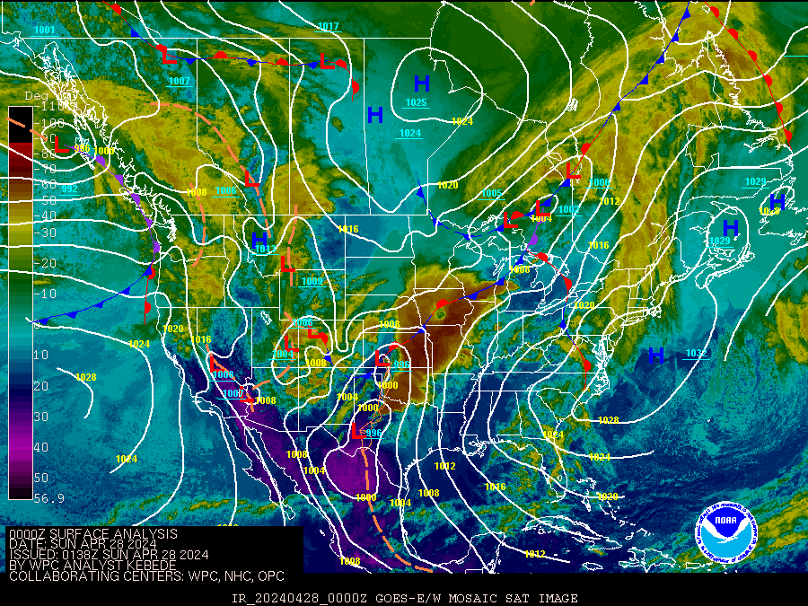 | 1800Z | 2100Z | Mar 30: | 0000Z | 0300Z | 0600Z | 0900Z | 1200Z |
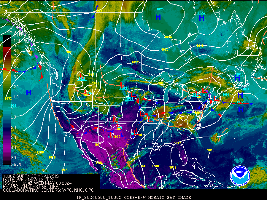
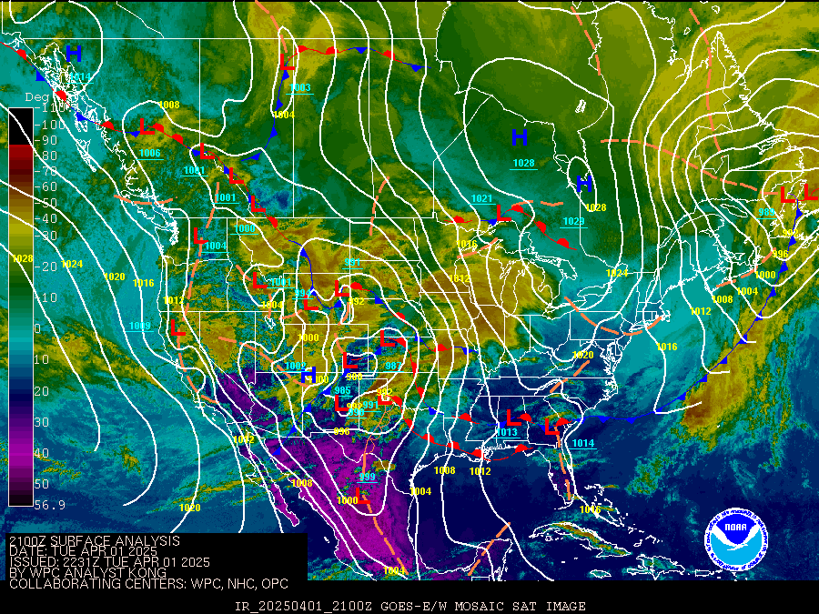
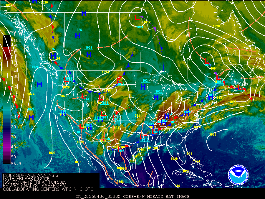
These maps are updated about 2 hours after their indicated analysis time.
(The next updates will be the 1500Z maps at about 1700Z when this page will refresh automatically.)
Looped Images
Maps and Data Courtesy of NOAA NWS Weather Prediction Center North American Surface Analysis.
Script by SE Lincoln Weather.