029
FXUS64 KJAN 152312 AAA
AFDJAN
Area Forecast Discussion...UPDATED
National Weather Service Jackson MS
612 PM CDT Tue Apr 15 2025
...New AVIATION...
.DISCUSSION...
Issued at 148 PM CDT Tue Apr 15 2025
Tonight and Wednesday:
High pressure is building in today in the wake of a cold front. Cold
air advection on breezy northerlies amid lowered humidity has
resulted in sufficient fire danger criteria to maintain the ongoing
Elevated outlook for the next few hours. As winds calm and skies
clear, temperatures fall into the mid and upper 40s F tonight.
Thursday into next week...
Steady temperatures increases are expected through the remainder of
the week, leveling off into the weekend with highs in the upper 80s
F. A few locations could briefly touch 90 F by Friday.
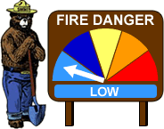
It currently appears thats fire weather danger likely will remain
low through the rest of the forecast period as combinations of low
humidity and gusty winds will likely not sufficiently rise to levels
of concern. Given the marginally favorable conditions, any forecast
changes that introduce somewhat drier or windier conditions than
currently forecast would result in increased concern. This will be
monitored as we move through the week.
Returning deep layer moisture will also likely result in slowly
increasing rain chances through the weekend into early next week
ahead of our next approaching cold front. Some guidance continues to
suggest the upper level trough will be sufficiently robust to result
in a frontal wave/cyclogenesis and this combined with likely at
least marginally supportive boundary layer thermodynamics could mean
storms Sunday into Monday. A few of these could be strong to severe.
Disagreement amongst guidance in both time and intensity will
preclude introduction of forecast graphics at this time, but it
appears likely that at least some of the area will have had a round
of thunderstorms by the time we get to the middle of next week. /86/
&&
.AVIATION...
(00Z TAFS)
Issued at 612 PM CDT Tue Apr 15 2025
VFR conditions are expected through the TAF period with mainly
light wind. /DL/
&&
.PRELIMINARY POINT TEMPS/POPS...
Jackson 46 77 53 83 / 0 0 0 0
Meridian 44 76 49 82 / 0 0 0 0
Vicksburg 47 78 55 84 / 0 0 0 0
Hattiesburg 45 78 50 84 / 0 0 0 0
Natchez 48 77 56 82 / 0 0 0 0
Greenville 48 75 56 82 / 0 0 0 0
Greenwood 47 76 55 81 / 0 0 0 0
&&
.JAN WATCHES/WARNINGS/ADVISORIES...
MS...None.
LA...None.
AR...None.
&&
$$
86/DL
NWS JAN Office Area Forecast Discussion


 Mt Washington Wx CAM