

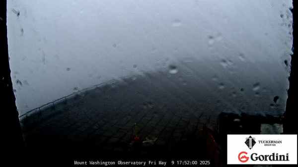
 Mt Washington Wx CAM


Boulder-NOAA Magnetometer Page

The geographic location of the Boulder-USGS geomagnetic observatory is N40.1 W105.2. Magnetometer values are the average of 60 1-second samples. The H component is directed along magnetic north, which is currently about 10 degrees east of geographic north. The D component is pointing 90 degrees clockwise relative to H. This is currently about 10 degrees south of geographic east.
The K-index
The K-index is a code that is related to the maximum fluctuations of horizontal components observed on a magnetometer relative to a quiet day, during a three-hour interval. The conversion table from maximum fluctuation (nT) to K-index, varies from observatory to observatory in such a way that the historical rate of occurrence of certain levels of K are about the same at all observatories. In practice this means that observatories at higher geomagnetic latitude require higher levels of fluctuation for a given K-index. The conversion table for the Boulder magnetometer is shown below:
|
K
|
nT
|
|---|---|
|
0
|
0-5
|
|
1
|
5-10
|
|
2
|
10-20
|
|
3
|
20-40
|
|
4
|
40-70
|
|
5
|
70-120
|
|
6
|
120-200
|
|
7
|
200-330
|
|
8
|
330-500
|
|
9
|
>500
|
SWPC monitors the preliminary values of the K-index, minute by minute, from a network of observatories that relay data in near-real time. The final K-indices are determined after the end of prescribed three hourly intervals (0000-0300, 0300-0600, ..., 2100-2400). The maximum positive and negative deviations during the 3-hour period are added together to determine the total maximum fluctuation. These maximum deviations may occur anytime during the 3-hour period.
The relationship between K, Kp, and estimated Kp
The official planetary Kp index is derived by calculating a weighted average of K-indices from a network of geomagnetic observatories. Since many of these observatories are not currently available to SWPC in real-time, it is necessary for an operations center such as this to make the best estimate they can of this index based on available data. The Space Weather Prediction Center calculates a near real-time estimates of the Kp index using a method described by Takahashi et al. (JGR 106, A10, pp21017, 2001). The network of contributing stations are possible through the cooperative efforts between SWPC and data provider partners which currently include the U.S. Geological Survey, the British Geological Survey, and the Institut de Physique du Globe de Paris. Ongoing development work and negotiations are in progress which will augment the network to include contributions from the Korean Communications Commission, Geoscience Australia, and the Geological survey of Canada.
Using minute-by-minute station K-indices, SWPC monitors the estimated Kp index in near real-time and issues alerts when thresholds are crossed.
In addition, the end-of-period NOAA estimated Kp index is used on announcements and appears on their web site.
The relationship between K and A
The A-index was invented because there was a need to derive some kind of daily average level for geomagnetic activity. Because of the non-linear relationship of the K-scale to magnetometer fluctuations, it is not meaningful to take averages of a set of K indices. What is done instead is to convert each K back into a linear scale called the "equivalent three hourly range" a-index (note the lower case). The daily A index is merely the average of eight "a" indices. The following table illustrates the conversion between K and "a":
|
K
|
a
|
|---|---|
|
0
|
0
|
|
1
|
3
|
|
2
|
7
|
|
3
|
15
|
|
4
|
27
|
|
5
|
48
|
|
6
|
80
|
|
7
|
140
|
|
8
|
240
|
|
9
|
400
|
Thus, for example, if the K indices for the day were 3 4 6 5 3 2 2 1, the daily A index is the average of the equivalent amplitudes:
A = (15 + 27 + 80 + 48 + 15 + 7 + 7 + 3)/8 = 25.25
The relationship between the NOAA G-scale and Kp
The Kp scale is a reasonable way to summarize the global level of geomagnetic activity, but it has not always been easy for those affected by the space environment to understand its significance. The NOAA G-scale was designed to correspond, in a straightforward way, to the significance of effects of geomagnetic storms. NOAA uses estimates of the planetary average Kp index in their operations to determine Geomagnetic Storm (NOAA Space Weather Scale) level, as follows:
| Kp-index | NOAA Space Weather Scale Geomagnetic Storm Level |
|---|---|
|
Kp=5
|
G1
|
|
Kp=6
|
G2
|
|
Kp=7
|
G3
|
|
Kp=8
|
G4
|
|
Kp=9
|
G5
|
Kp of 0 to 4 is below storm, which is labeled G0.
Limitations
Due to real-time requirements for the information, these alerts have to be based on measurements from the contributing real-time magnetometer network. This usually works fine but there is a possibility that there could be small differences between the real-time estimate and the official value since the network of observatories is not identical. Users should also beware that it can occasionally happen that a highly localized disturbance will affect a customer's region of operations, and yet the severity of the disturbance is not seen in the globally averaged index. The NOAA scale describes effects for various levels of activity, but with regards to geomagnetic activity, it needs to be kept in mind that there can be differences in the response that are a function of the location of the user.